

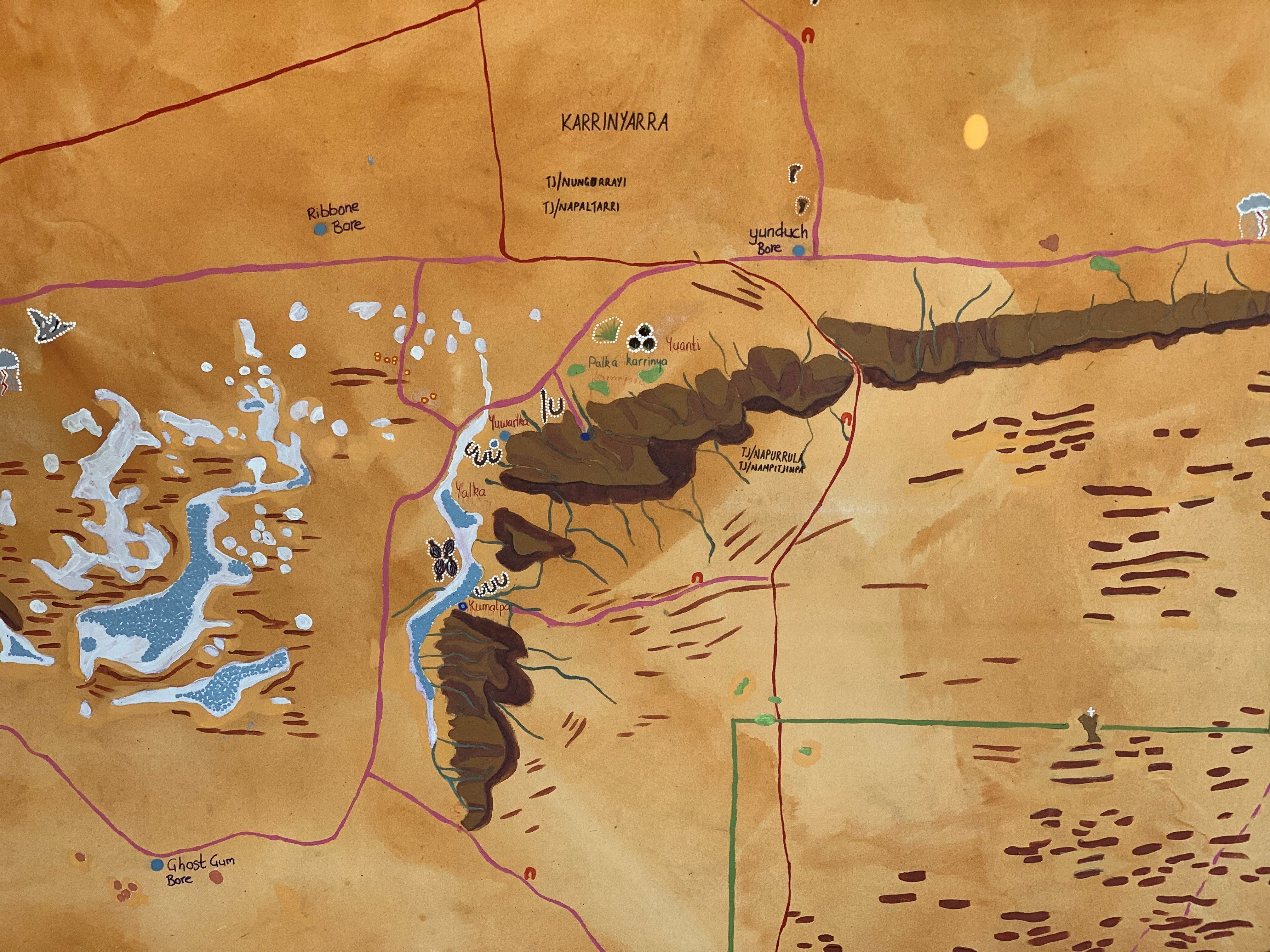
The Ngalurrtju Aboriginal Land Trust, located in the Northern Territory, now has a unique map created in collaboration between traditional owners and conservationists.
This special map, known as a "two-way" map, brings together the knowledge of the Anmatyerr, Warlpiri, and Luritja speakers, who are the custodians of the land, with the understanding of the Western world.
The map aims to make communication and decision-making easier for everyone involved in managing this important and valuable area.
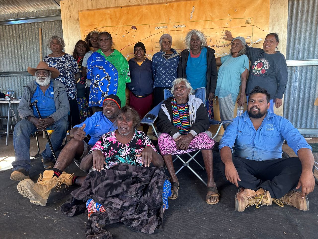
In May, a workshop took place over the course of one week to create the base layer of the map. The workshop was facilitated by Kim Mahood, an Australian author and artist.
Over 30 individuals participated, including representatives from four Indigenous estate groups (Waturlpunyu, Karrinyarra, Yuntarrju, and Mala), as well as land managers and ecologists from the Australian Wildlife Conservancy (AWC).
This workshop marked the beginning of a collaborative agreement between the traditional owners, the Central Land Council (CLC), and AWC.
The agreement aims to build cooperation in land management, scientific research, and cultural exchange within the land trust.
AWC Operations Manager at Ngalurrtju Steve Eldridge said it is a privilege to be involved in the two-way mapping project.
He believes the map will be valuable in deepening relationships and the successful management of Country.
"We're coming from two different points of view, but traditional and western information is crucial for managing Ngalurrtju," Mr Eldridge said.
"The two-way map captures a knowledge exchange whereby Traditional Owners are sharing significant stories and land management information from their perspective, while we're providing geological and ecological history and western techniques for animal monitoring and weed/land management.
"The map is used during meetings and events as a pictorial tool that ensures everyone is on the same page. And it's already proving to be valuable."
(Image: Supplied)
Designed to evolve over time, the map will serve as a living document with continued updates surrounding new information about Ngalurrtju as it becomes available.
Future workshops will see contributors adding vegetation layers to the map and highlight areas where weeds have been identified.
"While restoring this patch of country back to good health and managing it for conservation, we're also learning so much from traditional owners and seeing the land from their perspective," Mr Eldridge added.
The traditional owners are enthusiastic about the partnership and the opportunities it will provide.
"We are excited to be working together with AWC to look after our country, working two ways," Traditional Owner Terence Abbott said.


