
Residents of remote Kimberley communities have been told to make final preparations as Tropical Cyclone Hayley nears, with warnings it is likely to make landfall as a Category 3 system on Tuesday night.
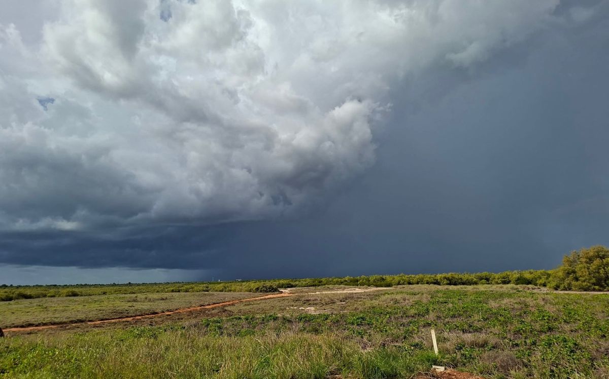
Hayley has developed rapidly in the past 24 hours, intensifying to a Category 4 storm overnight, and despite expected slight easing before crossing the coast, 'severe impacts' and 'very destructive winds' are expected in the northwest Kimberley from Tuesday afternoon.
The cyclone is currently expected to first make landfall just south of Cape Leveque on the Dampier Peninsula on Tuesday night.
It is currently 240 kilometres west of Cape Leveque and 255 kilometres northwest of Broome, moving towards the coast at 12 kilometres per hour.
An evacuation centre has been established at the Broome Recreation and Aquatic Centre.
A warning zone has been issued by the Bureau of Meteorology for the area north of Broome to Kuri Bay further northeast, including the Dampier Peninsula and Derby.
WA's Department of Fire and Emergency Services (DFES) have issued a Watch and Act Alert for the same area, warning "possible threat to lives and homes as a cyclone is approaching the area".
"You need to act now and get ready to take shelter from the cyclone," DFES issued at 6:15am Tuesday local time.
"Make final preparations now to ensure you are ready for the cyclone. An Emergency Warning - Take Shelter Now is expected to be issued this morning."
According to reports, residents in Beagle Bay, Cockatoo Island and Derby have been warned leaving is no longer safe.
The Department has advised those expecting to be impacted in the area to prepare emergency kits with a week's worth of canned food and water, a first aid kit, medication, cash and have a battery-operated AM/FM radio to continue listening to warnings.
People have also been advised to charge their mobile phones and make preparations around the home, such as securing loose items in the backyard and boarding up exposed windows.
As of Monday evening, people in the Aboriginal community of Djarindjin near the Dampier Peninsula's northern tip were starting to 'batten down the hatches' with some making evacuation plans for the morning.
"The sense in the community is it's another storm. It's not complacency. There's just more calmness....we've done everything we possibly can," Djarindjin Aboriginal Corporation chief executive Nathan McIvor told National Indigenous Times on Monday evening.
Hayley has intensified and warnings have been updated in the time since.
"We've got some people that do want to travel into Broome to go to the evacuation centres. So we're organising (buses for) that tomorrow for people who want to do that," Mr McIvor said.
"We're just battening down the hatches, and we'll be riding it out."
Some local community members had already left for Broome.
Mr McIvor said preparations for severe weather events had been made in the months leading into the wet season.
With the coming storm, "we've done everything we possibly can to, you know, stop debris from flying through the air", he said.
Djarindjin relies on power for water.
"Every time now that the power goes out, we lose water. So what we've done as an organisation is we've made sure that we've got plenty of cold storage and dry storage, as well as plenty of pallets of water, including pallets sitting in Broome waiting to come up if we do need to use water in an emergency, which is likely to occur, because it's more than likely the power will go out," Mr McIvor said.
In Broome on Monday night, the outlook was more optimistic.
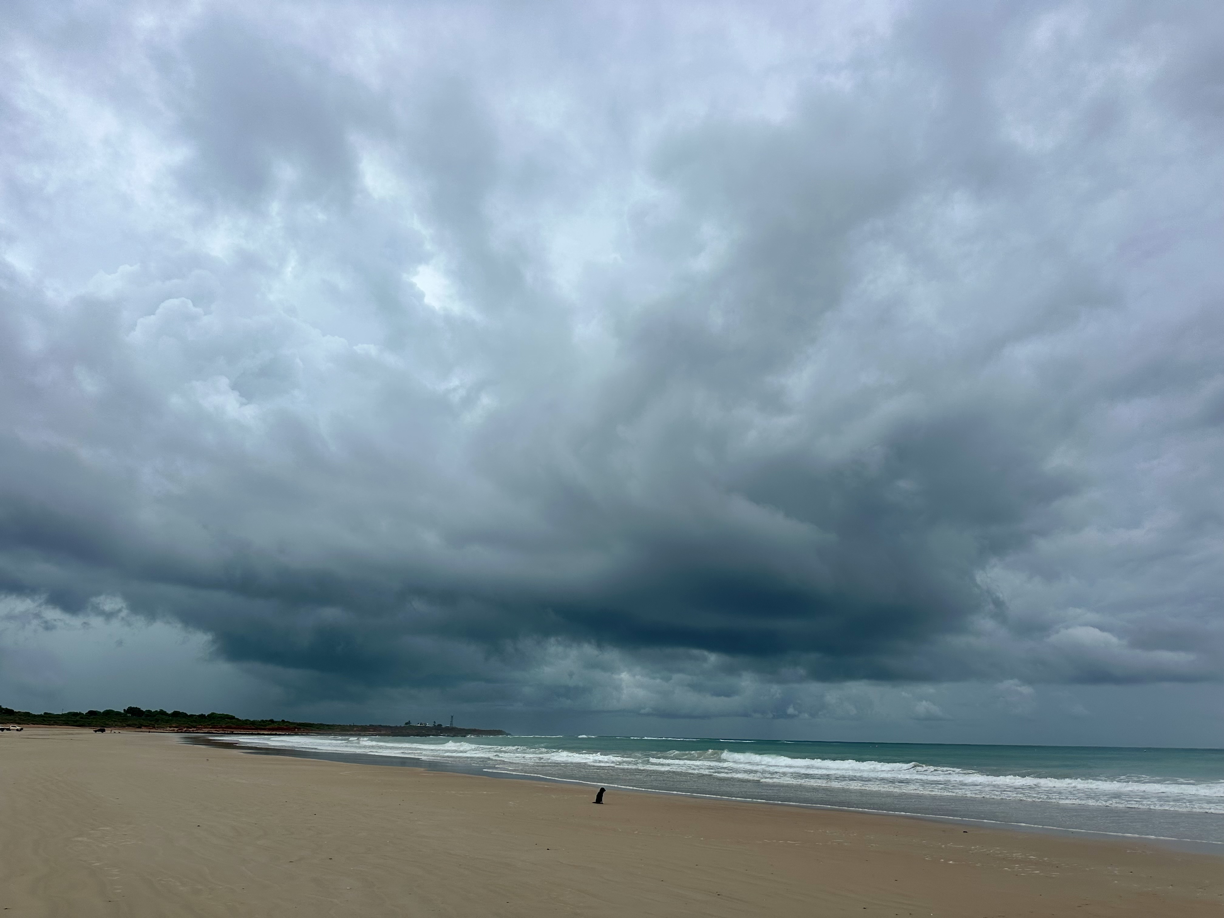
Broome itself no longer sits within the Bureau's warning zone, though the brewing storm was visible yesterday evening.
Yawuru man and local tourism business operator, Bart Pigram, told National Indigenous Times warnings for Hayley came through with less notice than usual.
"We've only had a few major, big cyclones...not many," he said.
"Me and my family aren't too worried. We just do the general (preparation) thing around the house."
Mr Pigram said updates to community warning systems and alert gradings he normally refers to had made it more difficult to confirm "how much at risk we are...it's not the old system we're used to".
'Very destructive' wind gusts of up to 170 kilometres are possible for the northern Dampier Peninsula from early Tuesday afternoon, the Bureau has advised, with gusts up to 150 kilometres likely from north of Broome to Cape Leveque as early as midday.
Flash flooding from heavy rainfall is possible in the warning area, with tides higher than normal anticipated on the west Kimberley coast.


