

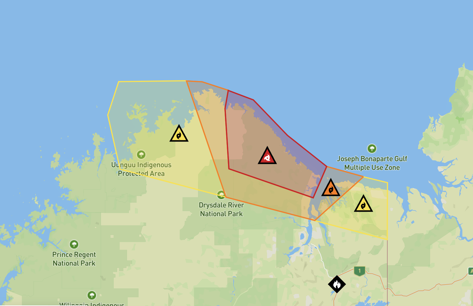
A cyclone warning is in place for remote WA communities lying between the Cambridge Gulf near the NT border and west to Faraway Bay after Tropical Cyclone Fina made landfall over the Kimberley Coast on Monday evening.
The slowly moving system has been downgraded to a category 2, with sustained winds of 100km per hour, and gusts of 140km per hour, and is expected to weaken further throughout Tuesday.
People between the Cambridge Gulf to Faraway Bay have been warned to 'shelter indoors now' by the WA Department of Fire and Emergency Services
"There is a threat to lives and homes. You are in danger and need to act immediately," DFAT said.
Only a handful of people live in the expected immediate path of Fina.
The advice:
- Shelter indoors now. It is too late to leave.
- Stay in the strongest, safest part of the building.
- Stay away from doors and windows, and keep them closed.
- Keep your emergency kit with you.
- Do not go out on the water while cyclone warnings are active as vessels can become overpowered, and rescues may not be immediately possible due to the dangerous weather.
- Stay indoors until Emergency Services advise it is safe to go outside.
- Watch for changes in water levels due to higher than normal tides as the cyclone moves closer to the coast.
A 'Watch and Act' warning and advice to put cyclone plans into action, is in place for the larger area west of Fawarway Bay, to east of Governor Islands, north of Oombulgurri and north-west parts of Cambridge Gulf.
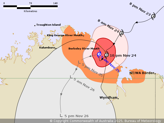
It is expected Fina will weaken further throughout Tuesday as it continues moving inland, the Bureau of Meteorology said on Tuesday morning at 5:30am local time.
Destructive winds of 155km per hour are occurring between King George River Mouth and southeast of Berkeley River Mouth, with damaging winds along the Kimberley coastline between King George River Mouth and the Cambridge Gulf.
These winds could impact inland areas east of Kalumburu later on Tuesday.
Flash flooding is possible in some areas as heavy to intense rainfall comes down, with high tides and large waves in coastal areas.
Conditions are expected to weaken throughout Tuesday.
The BOM has maintained a warning zone between King George River Mouth to Berkeley River Mouth.
Fina battered the Top End over the weekend, including Darwin and the Tiwi Islands with recovery and cleanup efforts continuing.
As of Monday, no major injuries or deaths had been reported.
On Monday afternoon, PowerWater NT updates power had been restored to 13,800 people.
Western Australia DFES warnings - Emergency WA
https://www.emergency.wa.gov.au/
Bureau of Meteorology - Tropical Cyclone Fina
https://www.bom.gov.au/warning/tropical-cyclone-advice/IDW24100


