

Weather warnings have been issued for Aboriginal and Torres Strait Islander communities across Far North Queensland as heavy rain associated with Ex-Tropical Cyclone Koji increases flooding and isolation risks.
Palm Island Aboriginal Shire Council issued an update as conditions continued.
The council urged residents to prepare early and support family members who may need help.
"With severe weather expected, please make plans now to move to a secure location if needed," they said.
"Check in with Elders, secure your pets, and ensure vulnerable family members have support and a safe place to stay."
Yarrabah Aboriginal Shire Council urged locals to prepare for impacts near Cairns.
The Council said severe weather could bring a mix of hazards, including flooding and power outages.
"YARRABAH COMMUNITY - GET READY Severe weather may impact Yarrabah with heavy rain, flooding, strong winds and power outages," Council said.
Hope Vale Aboriginal Shire Council said it is relying on its local arrangements as the wet season intensifies.
The council said its planning is in place to coordinate response and recovery when conditions deteriorate.
"To ensure we're ready to respond when severe weather hits, Council have endorsed the Hope Vale Aboriginal Shire Council 2025-26 Local Disaster Management Plan," Council said.
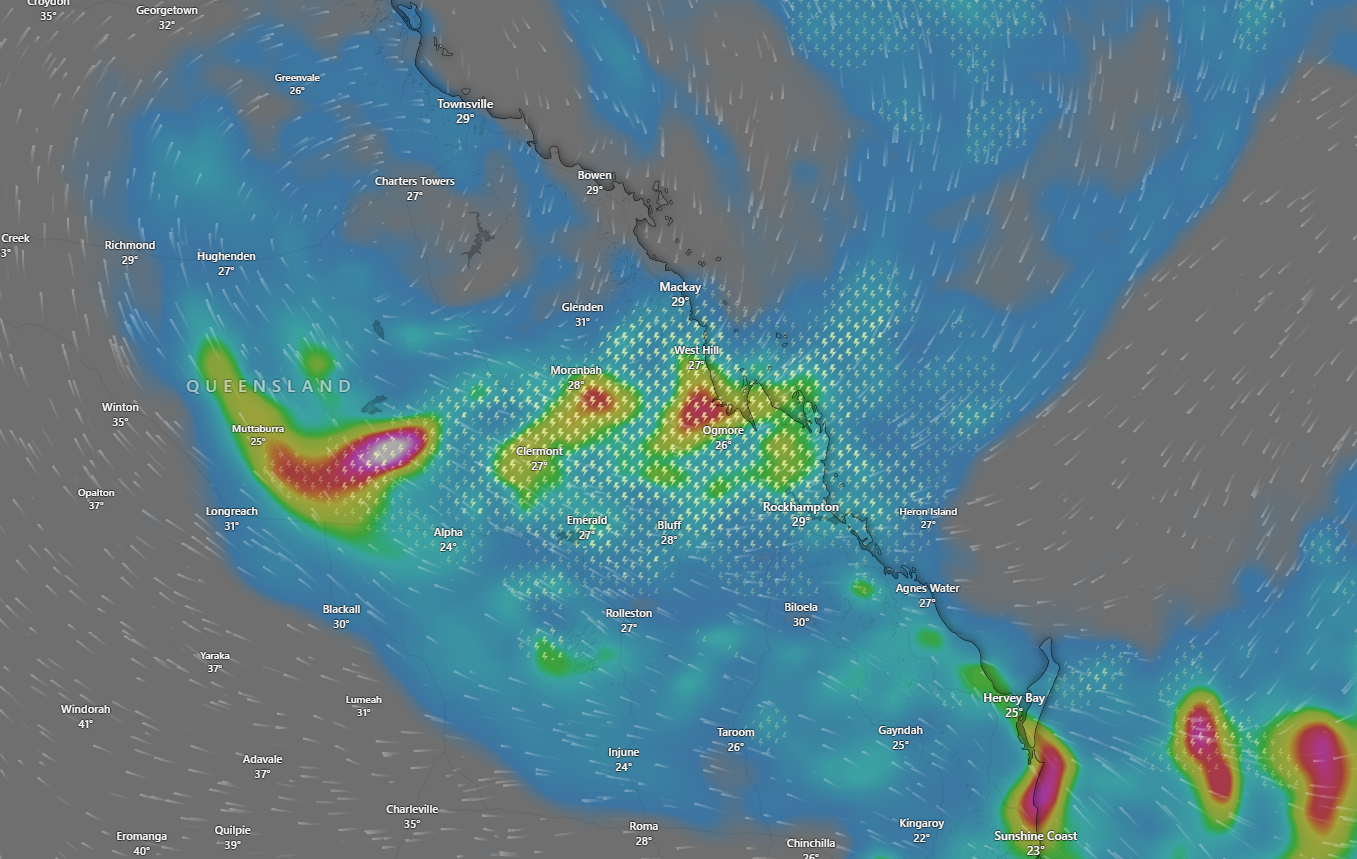
The Bureau of Meteorology said Ex-Tropical Cyclone Koji was over the Northern Goldfields and Upper Flinders district on Monday, weakening as it tracked slowly north-westerly over land.
Catchments along the central coast and inland were wet to saturated after recent rainfall, with rapid and dangerous river level rises likely.
Heavy rainfall is also possible in Wide Bay and Burnett, and parts of the Central Highlands and Goldfields over the next two days.
A separate initial flood watch is also current for the Gulf Country and parts of western Queensland and the Cape York Peninsula, including the Flinders and Cloncurry catchments.
Aboriginal and Torres Strait Islander communities spanning these warning areas include Yarrabah, Palm Island, Hope Vale, Wujal Wujal, and Gulf and Cape communities including Doomadgee, Mornington Island (Gununa), Burketown, Normanton, Kowanyama, Aurukun and Pormpuraaw.
The bureau notes minor to moderate flooding was possible from Thursday, with the heaviest rainfall at this stage likely over the Gulf Country.
It said prolonged ongoing flooding was occurring in some catchments, with localised flash flooding likely in the heaviest falls.
The Bureau also warned further isolation of communities and disruption to transport routes was likely.
Catchments listed in the flood watch include Settlement Creek, the Mitchell, Nicholson, Leichhardt, Gilbert and Staaten rivers, and the Upper and Lower Flinders, Cloncurry and Norman rivers.


